

Bhubaneswar: Odisha is preparing for another spell of intense rainfall after a low-pressure area over the Bay of Bengal intensified into a depression, prompting the India Meteorological Department (IMD) to issue warnings for several districts.
The weather system is currently positioned around 180 km from Balasore and is expected to move towards West Bengal, Jharkhand and Bihar over the next 24 hours. Its movement is likely to influence rainfall activity across Odisha, particularly in the northern districts.
With several areas of the state already experiencing waterlogging and rising river levels, the fresh spell of heavy rain could increase the risk of flooding in vulnerable and low-lying locations.
Red Alert Issued for Three Odisha Districts
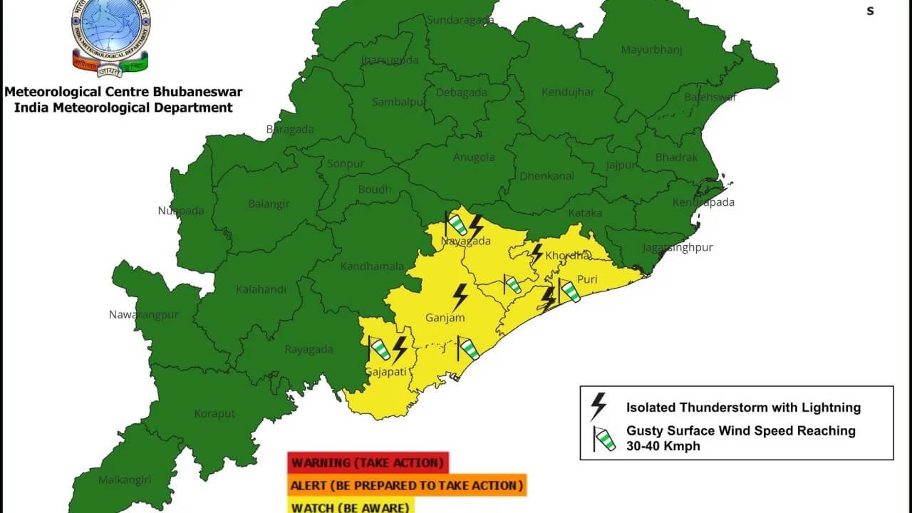
The IMD has issued a red warning for extremely heavy rainfall in Mayurbhanj, Balasore and Kendrapara for today.
Residents in these districts have been advised to remain cautious as intense rainfall could lead to waterlogging, flooding, disruption of road connectivity and other weather-related problems.
The warning is particularly significant for northern Odisha, where the depression is expected to have its strongest influence as it moves closer to the coast and subsequently towards neighbouring states.
11 Districts Under Orange Alert
Apart from the three districts under red warning, 11 other districts have been placed under an orange alert.
The alerts indicate the possibility of heavy to very heavy rainfall and associated disruptions. Authorities are monitoring vulnerable areas, especially locations that have already experienced waterlogging or rising water levels due to prolonged rainfall.
The latest weather system has added to concerns in several parts of Odisha that are still recovering from the impact of persistent rain.
Mayurbhanj And Balasore Likely To Receive Heavy Rain
According to the weather forecast, rainfall activity is expected to intensify over North Odisha, with Mayurbhanj and Balasore likely to experience heavy to very heavy rainfall.
An IMD expert said rainfall intensity was relatively low at present but was expected to increase and continue through the following day.
Meanwhile, Nayagarh, Khordha and Jagatsinghpur are likely to experience light to moderate rainfall.
Weather conditions may become relatively dry on August 19, although another weather system could soon bring fresh rainfall to the state.
Another Low-Pressure Area May Form Around August 21
The IMD has indicated the possibility of another low-pressure area forming around August 21.
If the system develops as anticipated, fresh rainfall activity could occur across Odisha on August 22 and 23, potentially extending the ongoing wet spell.
The successive weather systems have increased the need for continued monitoring, particularly in districts that are already vulnerable to flooding and waterlogging.
Strong Winds Expected In Northern Odisha
The depression is also expected to bring strong winds to parts of the state.
According to the weather assessment, wind speeds of around 80 to 120 kmph could occur over parts of Sundargarh, Mayurbhanj and Balasore.
Meanwhile, districts including Kendrapara, Puri, Khordha and Bhadrak are expected to experience varying intensity of rainfall, ranging from light to heavy.
Residents in coastal and vulnerable areas have been urged to remain alert and follow advisories issued by local authorities.
Flood Situation Remains A Concern
The latest depression comes at a time when several parts of Odisha are already dealing with the effects of persistent rainfall. Waterlogging has been reported in vulnerable areas, while rising river levels have increased concerns over possible flooding.
The movement of the depression towards West Bengal, Jharkhand and Bihar over the next 24 hours will remain closely monitored as its influence could continue to affect weather conditions across Odisha.
Authorities are keeping a watch on rainfall intensity, river levels and vulnerable locations as the state prepares for another spell of potentially severe weather.