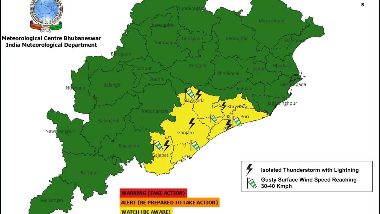


Odisha is likely to remain under the influence of active weather systems for the next several days, with rainfall expected to continue across the state for nearly another week. A low-pressure area over the northwest Bay of Bengal and adjoining regions is currently influencing weather conditions, prompting the weather department to issue red and orange warnings for several districts.
The persistent rainfall comes as many parts of Odisha continue to experience wet conditions, with authorities closely monitoring areas vulnerable to waterlogging, flooding and other rain-related disruptions.
Red Warning for Cuttack, Angul and 3 Other Districts
A Red Warning has been issued for Cuttack, Angul, Dhenkanal, Kalahandi and Nabarangpur, where heavy to very heavy rainfall is expected.
Residents in these districts have been advised to remain cautious, particularly in areas vulnerable to flooding, landslides and waterlogging. District administrations have also been urged to remain prepared for possible weather-related emergencies.
Orange Warning Covers Several Districts
An Orange Warning has been issued for several districts across coastal and northern Odisha, besides Sambalpur, Deogarh, Sonepur, Boudh, Kandhamal, Koraput, Malkangiri, Nayagarh and Rayagada.
During the next 24 hours, Sundargarh, Jharsuguda, Bargarh, Sambalpur, Sonepur and Boudh are likely to experience heavy to very heavy rainfall.
Authorities have been advised to closely monitor the situation as intense rainfall could affect road connectivity, low-lying areas and normal daily activities.
Strong Winds and Rough Sea Conditions
The weather system is also expected to influence conditions over the sea.
Winds reaching 40 to 50 kmph are likely over the northwest and adjoining west-central Bay of Bengal, as well as along the coasts of West Bengal, Odisha and northern Andhra Pradesh.
With the sea expected to remain rough, fishermen have been advised not to venture into the sea.
A No. 3 danger signal has also been hoisted at ports along the Odisha coast as a precautionary measure.
More Heavy Rain Expected Between August 24 and 26
According to the extended weather outlook, another spell of heavy to very heavy rainfall is likely between August 24 and 26.
Mayurbhanj, Keonjhar, Balasore, Bhadrak and Sundargarh are among the districts likely to receive significant rainfall during this period.
The upper catchment areas of rivers are also expected to receive heavy rain, which could increase water levels in rivers and potentially worsen flooding in vulnerable locations.
Rainfall Activity to Continue Into Late August
The wet spell is expected to continue beyond August 26.
Around August 27 and 28, heavy rainfall is likely in Bargarh, Jharsuguda, Nuapada, Kalahandi and Bolangir.
The weather department has also indicated the possibility of another cyclonic circulation developing over the Bay of Bengal around August 29-30.
This system could subsequently develop into another low-pressure area between August 31 and September 1, potentially triggering another phase of rainfall over Odisha.
Authorities Asked to Remain Alert
With multiple weather systems expected to influence Odisha in the coming days, district administrations are likely to maintain heightened preparedness in vulnerable areas.
The combination of persistent rainfall, rising river levels, rough sea conditions and additional weather systems could increase the risk of flooding and waterlogging in several parts of the state.
Residents in districts under red and orange warnings are advised to follow official weather updates and avoid unnecessary travel during periods of intense rainfall.