

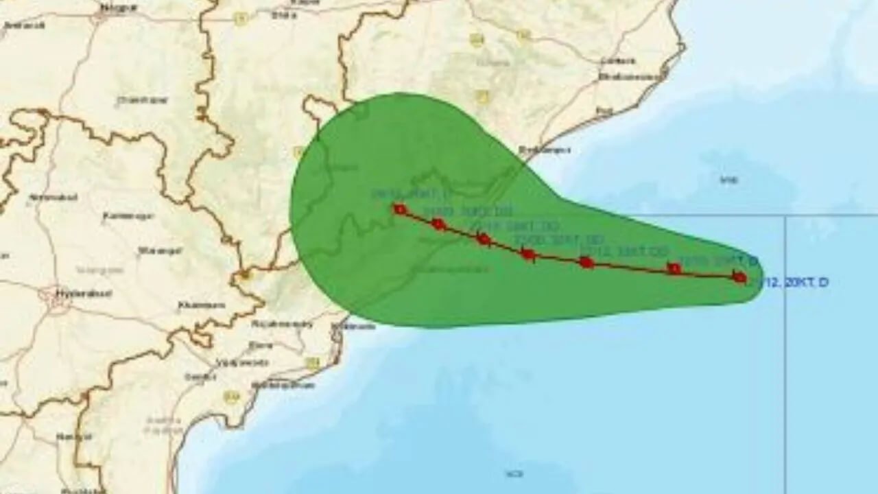
A depression over the Bay of Bengal is likely to intensify into a deep depression by Tuesday evening, increasing the possibility of heavy to extremely heavy rainfall across several parts of Odisha.
According to the India Meteorological Department (IMD), the system was located around 220 km southeast of Gopalpur and 320 km east of Visakhapatnam.
The weather system is expected to move towards the Odisha coast and could cross the coast between Tuesday night and the early hours of September 24.
As the system approaches the coast, rainfall activity is expected to increase across southern, coastal and several interior districts of Odisha.
Depression Likely To Become Deep Depression Today
The weather system, which initially developed as a low-pressure area over the west-central and adjoining northwest Bay of Bengal, has already intensified into a depression.
The IMD has indicated that the depression is likely to strengthen further and become a deep depression by Tuesday evening.
Its proximity to the Odisha coast has prompted increased weather vigilance, particularly across the southern and coastal districts.
Although the system is currently positioned southeast of Gopalpur, its movement towards the coast could result in widespread rainfall across the state.
Red Alerts Issued For Several Districts
The IMD has issued multiple rainfall warnings for Odisha as the system moves closer to the coast.
On Tuesday, heavy to extremely heavy rainfall is possible from Malkangiri to Mayurbhanj. An orange warning has been issued for 13 districts, while nine districts are under a yellow warning.
The rainfall threat is expected to increase further from Wednesday.
Ganjam, Gajapati and Koraput are under a red warning for very heavy rainfall on September 23.
For September 24, red warnings have been issued for Malkangiri, Koraput, Kalahandi and Nabarangpur.
Residents in the affected districts have been advised to remain alert and follow updates issued by the meteorological department and local administration.
Heavy Rainfall Expected On September 23 And 24
The deep depression is expected to bring significant rainfall to Odisha on September 23 and 24.
Several areas could experience heavy to extremely heavy rainfall as the system moves closer to the coast and subsequently crosses the coastal region.
Southern Odisha is expected to remain particularly vulnerable because of the system’s projected movement and proximity to the state’s southern coastline.
Strong Winds Likely Along Coast
Apart from heavy rainfall, strong winds are also expected as the system approaches the Odisha coast.
Wind speeds could reach around 55 to 65 kmph, with gusts potentially touching 75 kmph.
The combination of heavy rainfall and strong winds could affect coastal areas and other districts along the system’s projected path.
Fishermen and people living in coastal areas are advised to follow official advisories and avoid taking unnecessary risks as marine conditions deteriorate.
Odisha Weather Under Close Watch
With the depression expected to strengthen further by Tuesday evening, authorities are maintaining close watch over the evolving weather situation.
The system’s movement towards Odisha and its expected coastal crossing between Tuesday night and early September 24 could bring a fresh spell of intense rainfall to several districts.
People are advised to monitor IMD bulletins and local administration advisories as the system gets closer to the Odisha coast.