

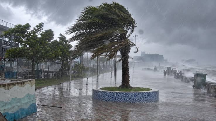
Bhubaneswar: The India Meteorological Department (IMD) has warned that a developing weather system over the Bay of Bengal may intensify into a cyclonic storm and approach the north Andhra Pradesh–south Odisha coast by the morning of October 28. Coastal Odisha is likely to experience rainfall from October 26, with heavy to very heavy showers forecast over several districts during the following days.
According to IMD officials, the system is expected to strengthen gradually from a low-pressure area into a depression and then a deep depression before potentially developing into a cyclonic storm. Wind speeds may also increase as the system moves closer to the coast.
However, the exact landfall location and the wind speed at the time of landfall have not yet been determined.
Cyclone May Intensify from October 26
IMD Director General Dr Mrutyunjay Mohapatra said the weather system is likely to develop into a depression on October 24, followed by a deep depression on October 25. It may subsequently intensify into a cyclonic storm over the west-central Bay of Bengal by the morning of October 26.
Wind speeds are expected to reach 70–80 kmph, with gusts of up to 90 kmph, according to the forecast cited in the report. Winds may strengthen further as the system approaches the coastline.
Mohapatra said the system is expected to move west-northwestwards towards the north Andhra Pradesh and adjoining south Odisha coast.
“The system is expected to move west-northwestwards and reach the sea near the north Andhra Pradesh and adjoining south Odisha coasts during the early hours of October 28. As the system moves closer to the coast, it is likely to intensify further, with wind speeds also expected to increase,” he said.
Odisha Rain Forecast: Heavy Showers from October 27
Rainfall is expected to begin in coastal Odisha from October 26 as the weather system develops over the Bay of Bengal.
According to the forecast provided by IMD officials, heavy to very heavy rainfall is likely on October 27, while extremely heavy rainfall may occur in some areas on October 28 and 29.
The anticipated rainfall could affect several coastal and inland districts, making it important for residents to follow official weather advisories as the system evolves.
IMD Director Manorama Mohanty Explains System Development
Odisha IMD Director Manorama Mohanty said a low-pressure area formed over the southeast and adjoining east-central Bay of Bengal at 5:30 AM IST on Friday.
She explained that the system was likely to intensify into a depression by October 24, a deep depression by October 25 and a cyclonic storm over the west-central Bay of Bengal by the morning of October 26.
The system is expected to move west-northwestwards and approach the north Andhra Pradesh and Odisha coasts over the following two days.
Her assessment highlights the potential for a developing weather system to influence rainfall and wind conditions across coastal Odisha.
Districts Likely to Receive Heavy Rainfall
According to Manorama Mohanty, Ganjam, Gajapati and Puri districts are likely to receive heavy to very heavy rainfall, with extremely heavy showers possible at isolated locations.
Heavy to very heavy rainfall is also expected at isolated places in the following districts:
- Mayurbhanj
- Keonjhar
- Balasore
- Bhadrak
- Jajpur
- Kendrapara
- Cuttack
- Khordha
- Jagatsinghpur
- Nayagarh
- Kandhamal
- Kalahandi
- Nabarangpur
The rainfall forecast may be revised as the weather system develops. Residents should therefore monitor district-specific warnings and updates from the IMD.
Cyclone Track and Landfall Location Yet to Be Confirmed
The developing system is forecast to approach the southern Odisha and north Andhra Pradesh coasts by the morning of October 28.
However, the IMD has not yet specified the exact landfall location or the expected wind speed at the time of landfall.
The final track and intensity will depend on the system’s development and movement over the Bay of Bengal. Forecasts may change as fresh meteorological observations become available.
The possibility of a cyclonic storm and its potential impact should therefore be understood in the context of the latest official forecast rather than as a confirmed landfall scenario.
Residents Advised to Follow Official Weather Updates
With heavy rainfall and strengthening winds forecast, residents in potentially affected districts should remain alert and follow advisories issued by the IMD and local administrations.
People should pay attention to updates regarding rainfall intensity, wind speeds and possible disruptions. Fishermen and those planning marine activities should follow official warnings and instructions concerning sea conditions.
Further bulletins are expected to provide greater clarity on the system’s movement, intensity and potential impact on Odisha’s coastline.