
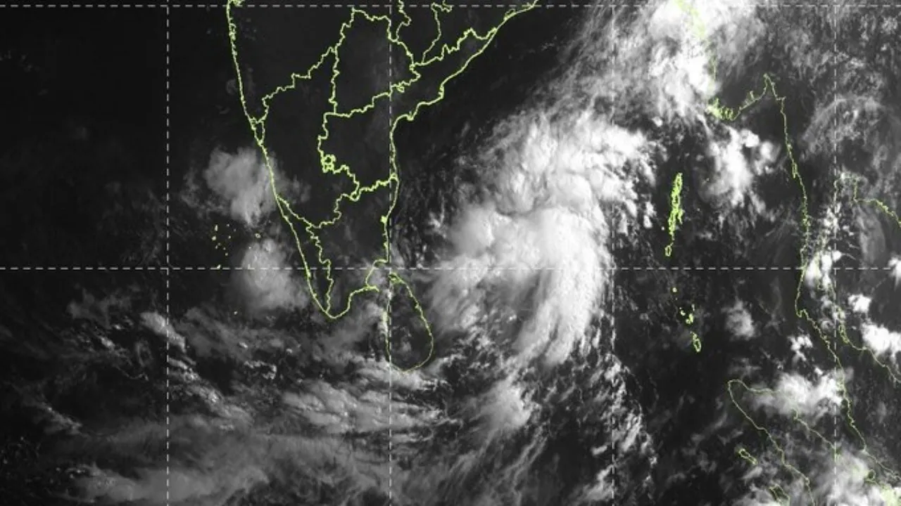
A low-pressure area has formed over the Bay of Bengal, specifically over the southwest sector off the Sri Lanka coast, under the influence of an active upper-air cyclonic circulation, according to the India Meteorological Department.
The weather system’s associated cyclonic circulation currently extends up to 5.8 km above mean sea level. The IMD said the system is likely to intensify further over the next 48 hours, although no rain or wind warning has been issued for Odisha so far.
System likely to move toward Tamil Nadu
Weather observers indicate the system is expected to move generally west-northwestward toward the Tamil Nadu coast.
Meteorologist Biswajit Sahoo said strong vertical wind shear over the region is likely to restrict rapid intensification. That means while the low-pressure area may strengthen modestly, the probability of it becoming a highly organised weather system remains low.
He noted that if atmospheric conditions become marginally more favourable, the system could briefly intensify into a depression around May 13 or 14, but current indicators do not strongly support major cyclogenesis.
Odisha may continue to see heat, isolated Kalbaisakhi showers
For Odisha, the immediate impact appears limited.
According to current assessments, the low-pressure system may either weaken near the Tamil Nadu coast or recurve eastward toward Myanmar, depending on how surrounding atmospheric conditions evolve.
If the system does intensify into a depression and tracks away from Odisha, heat conditions across the state could become more pronounced during the third week of May, with the possibility of heatwave conditions between May 15 and 20.
At the same time, Kalbaisakhi-related thunderstorms remain likely in parts of northern and coastal Odisha over the next two days. Districts that may receive brief showers include Mayurbhanj, Keonjhar, Balasore, Bhadrak, Dhenkanal, and Kendrapara.
What this means now
At this stage, the newly formed low-pressure area is a developing weather system, not an immediate threat to Odisha.
The main zone of influence currently remains closer to southern India, while Odisha is more likely to continue experiencing isolated pre-monsoon thunderstorm activity rather than direct low-pressure-related impacts unless the track changes substantially.